

On Locating Uru's Caldera
There are two images from the earliest days of Uru’s development that especially relate to a real-world Caldera. One was the DRC’s image from their website, first available on the 2007 version of the website:
The other originates from the Uru CC Prima guide, published in 2004:
Attempts to locate where these photos were taken and the volcanic feature they depicted, as well as other aspects of the Cleft landscape seen in-game, are old and legendary. The most famous is the research and legwork Ainia DaFente did, mostly in 2012-14, including a Mysterium presentation in 2014.
Ainia conducted her work looking for the Cleft in an IC format. She pursued several strands of logic to narrow down a range of NM in which to look. She considered geological formations and history, wildlife ranges, old trade routes, and caldera locations. Her many excursions netted a wealth of images of birds, petroglyphs, volcanoes, fences, and eerily familiar vistas.
I eagerly followed those excursions at the time, and shared in the excitement each new post would bring.
I took up locating the cleft originally c. 2020. Unlike Ainia, I do not live in NM and could not mount any expeditions. As this era wound done, I had compiled a series of candidates, mostly new, and substantially oriented around barbed wire fences and powerlines (taking strong cues from the Prima guide’s subtle but evocative clues), alongside geological shape. My guidelines were the entire state of New Mexico.
My leading candidate from that period became one of the Twin Buttes.
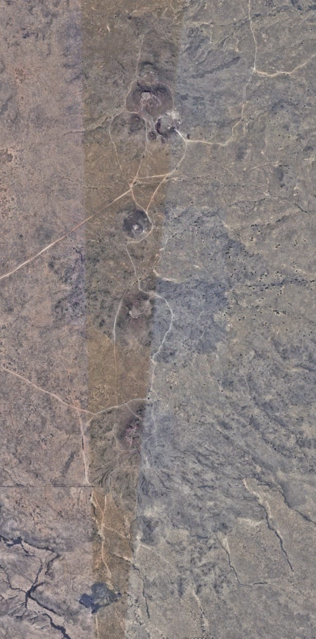
Other candidates were in Bernalillo county: multiple cones of the Three Sisters, or one of their two cousins, that make up a string of volcanoes to the west of Albuquerque, consequences of a fissure eruption.
Their shapes were tempting, but achieving a match proved elusive.
That was how I left it. Some notes, lots of ideas; eager, but nothing truly worthwhile.
Years later, I happened to go through all my old notes one day, familiarizing myself with where I left off, and remembering and updating my most promising prospects. At this point it was the Twin Buttes that still stood out as the best possibility, despite the extreme squinting required.
Yet, it also occurred to me that there could be an endearingly simple solution to the mostly rejected candidacy of the Three Sisters: 99% of all images and video of them available online were from the west, from where they were virtually always accessed. The “mirrored image problem,” which had disinclined me from favoring it, could be fixed with an eastern view.
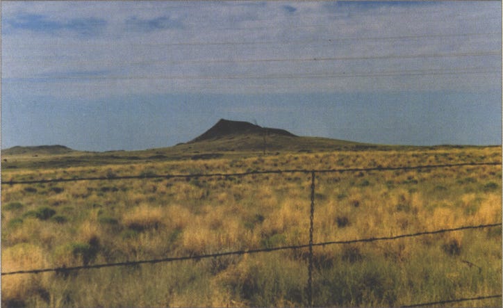
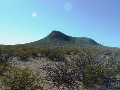
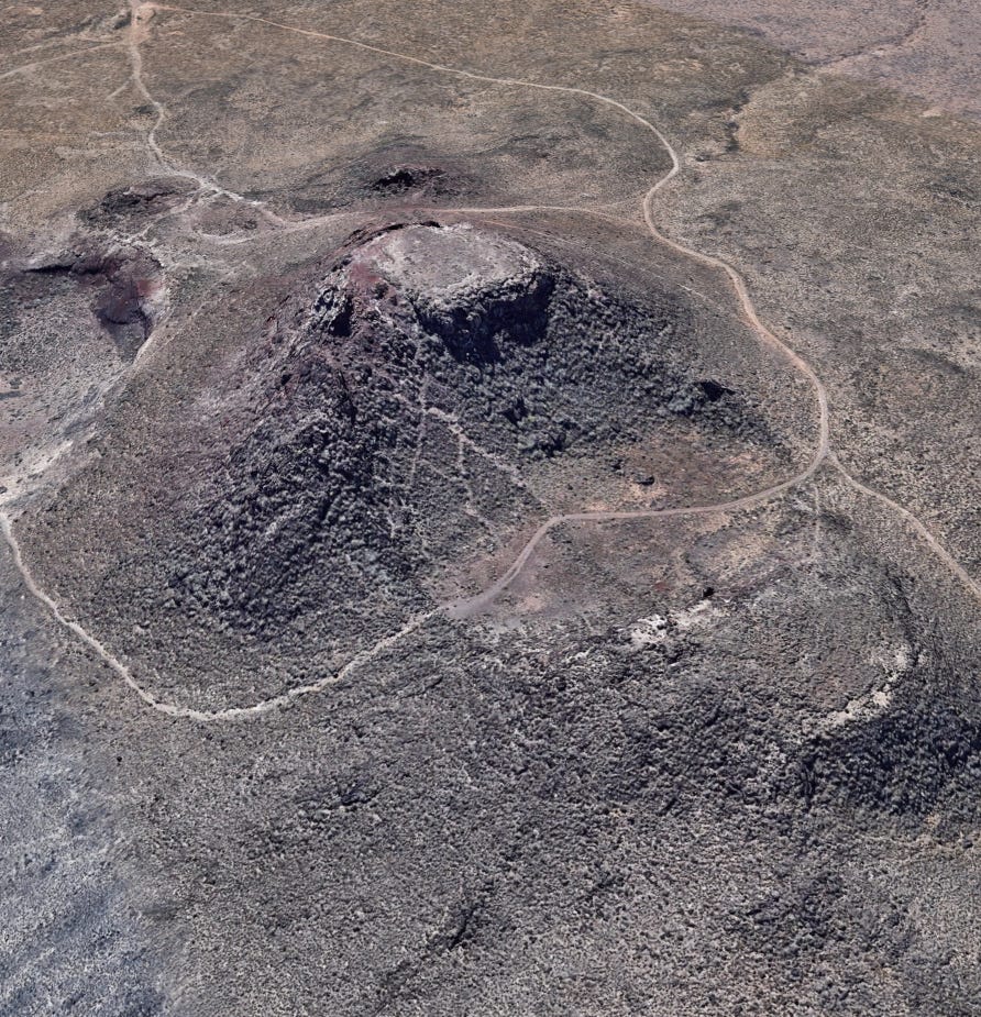
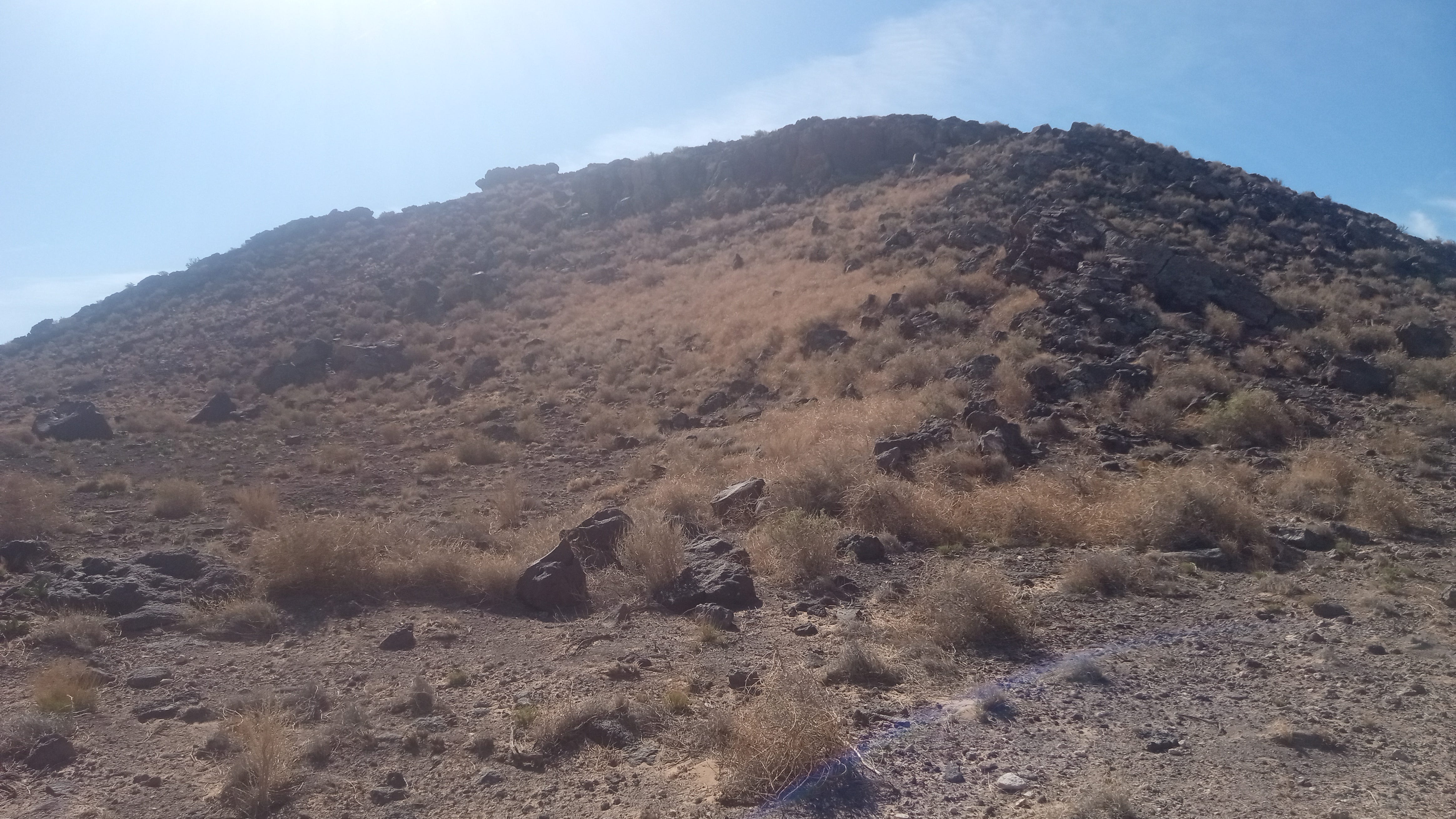
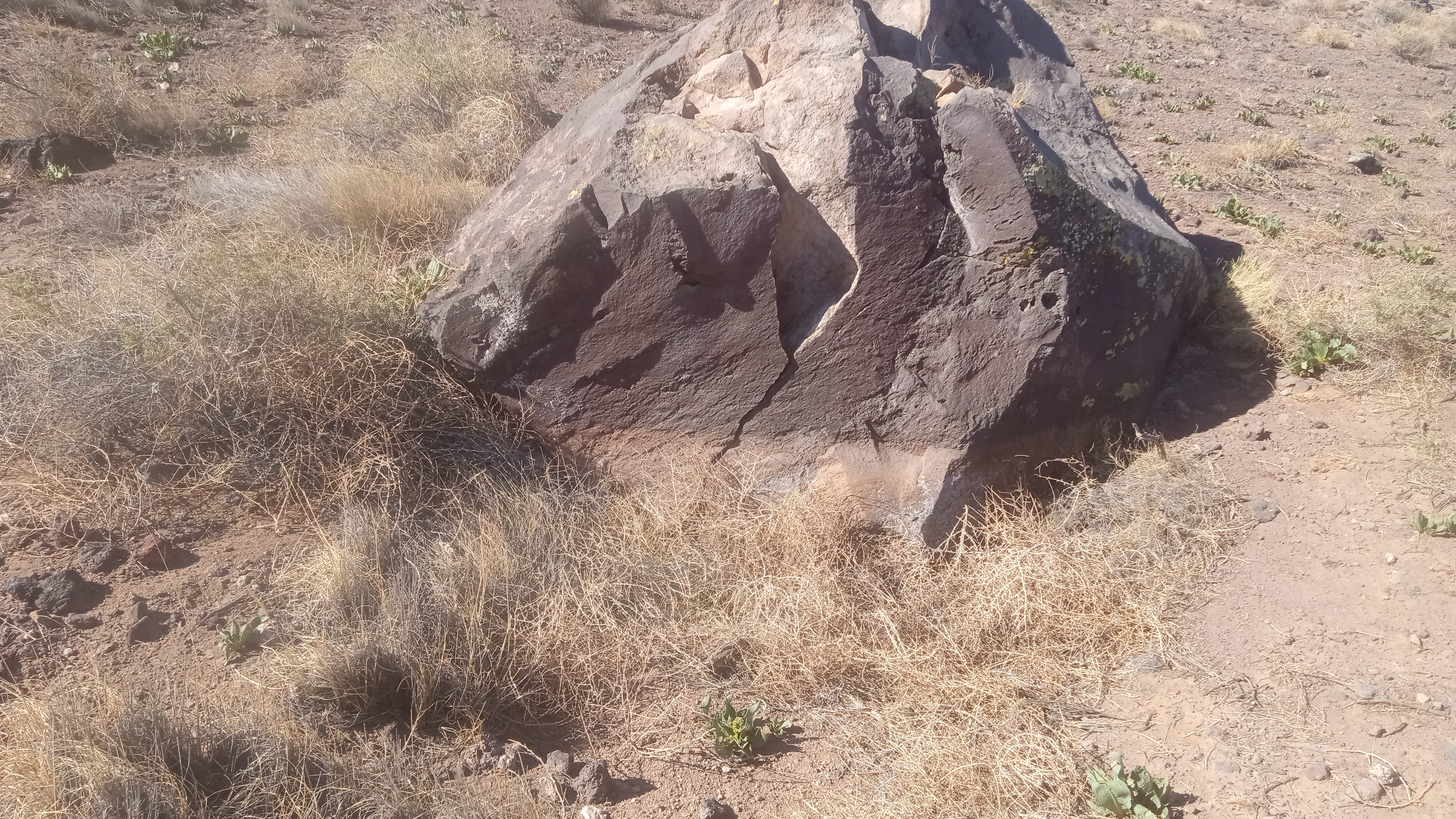
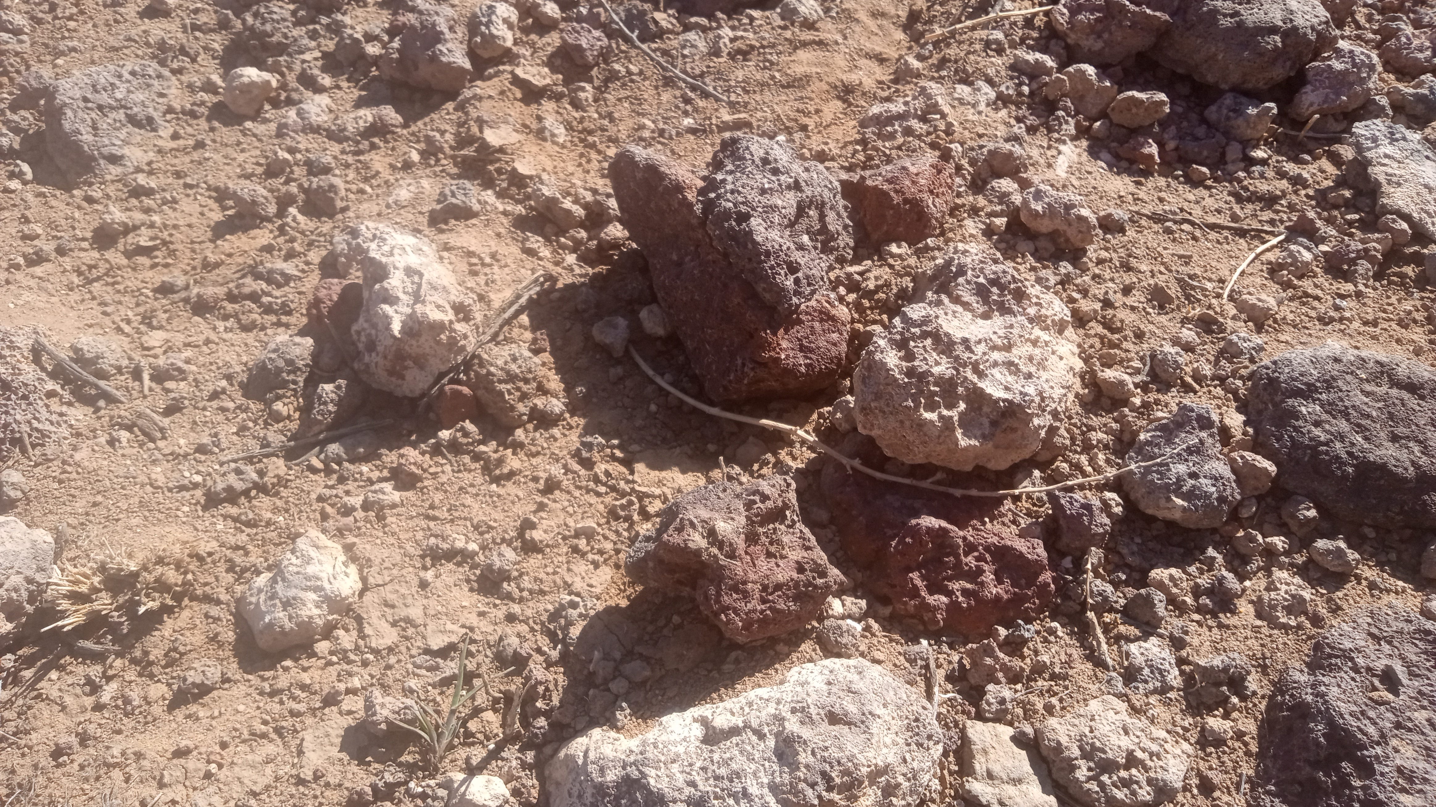
One of the Three Sisters, Vulcan (also known as J), especially looked promising if it could be viewed properly from the northeast. This volcano is a spatter cone, mostly formed by fountains of fire from the central vent, as well as from smaller vents on the cone’s flanks. Lava tubes grace it on multiple sides. A solidified lava pond of gray basalt occupies its crater. Old quarrying for construction material is responsible for carving out much of Vulcan, and for stranding a “hill” from its central cone.
After enough targeted research of such an angle, I wanted to go to New Mexico and get perfect replicas. Which, when I went to Bernalillo County, I did.
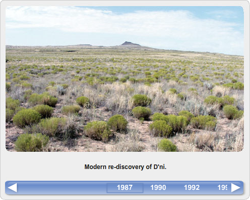
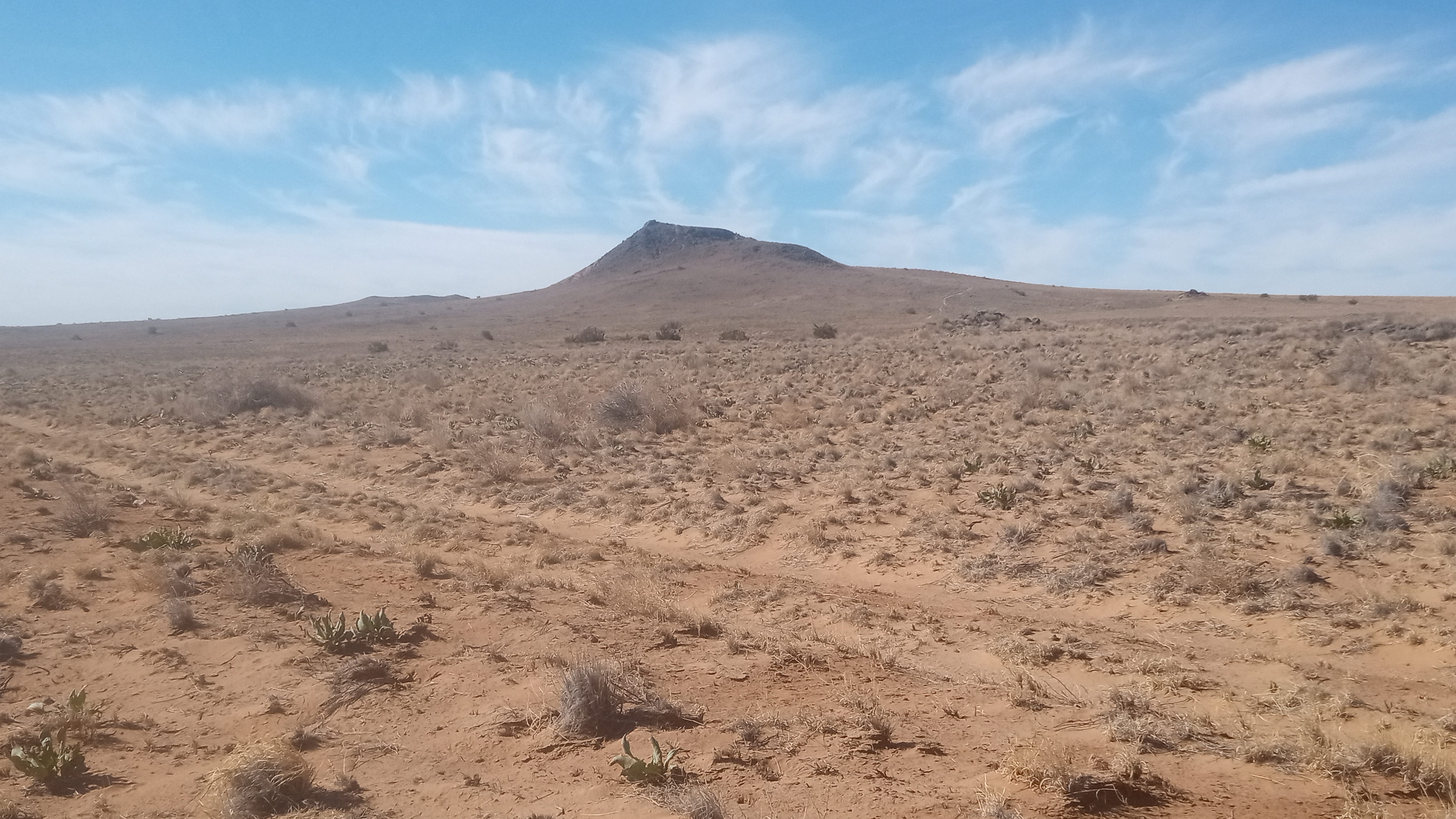
The DRC’s photo was taken from 35.159765, -106.756203:
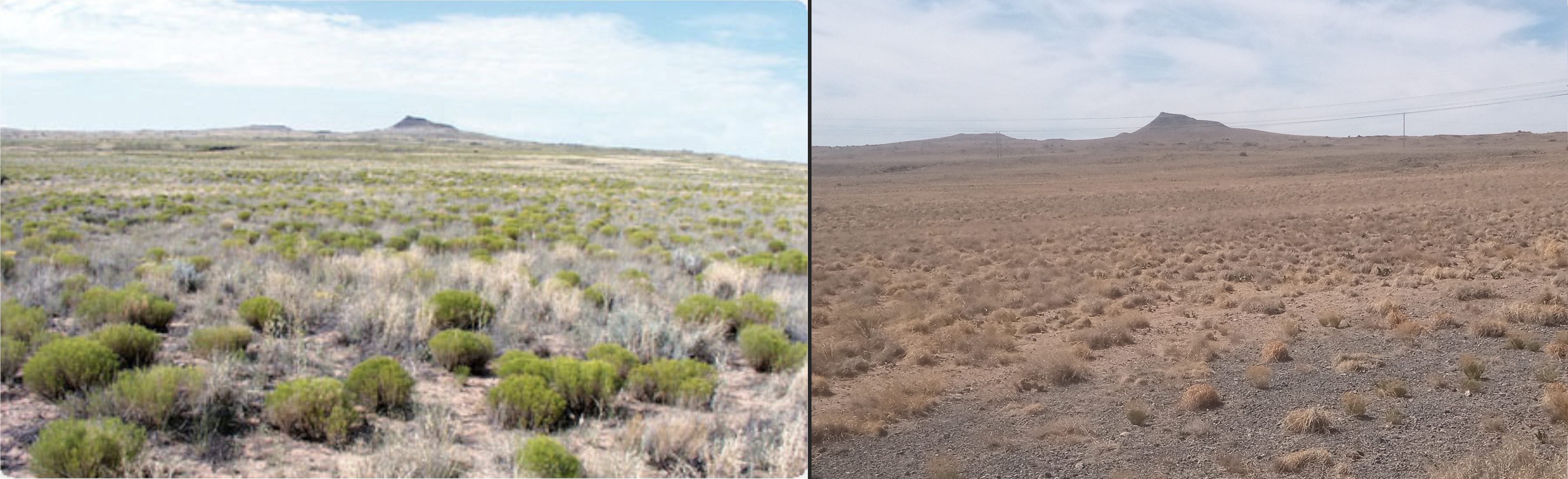
The Prima guide’s photo captures the volcano from 35.159853, -106.758377:
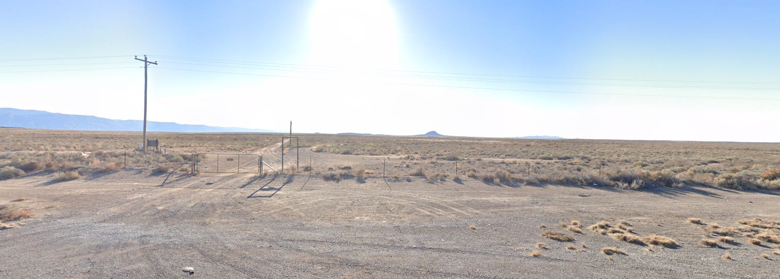
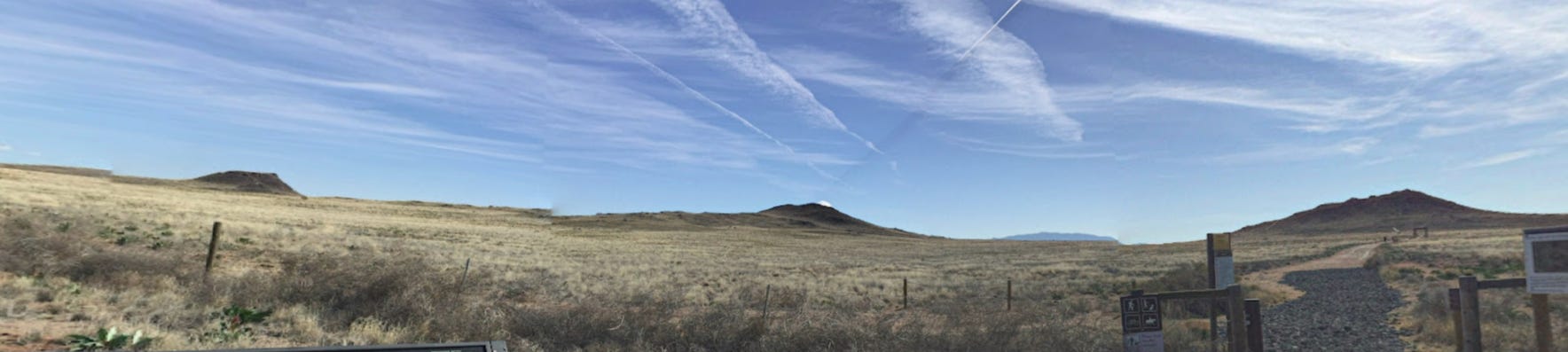
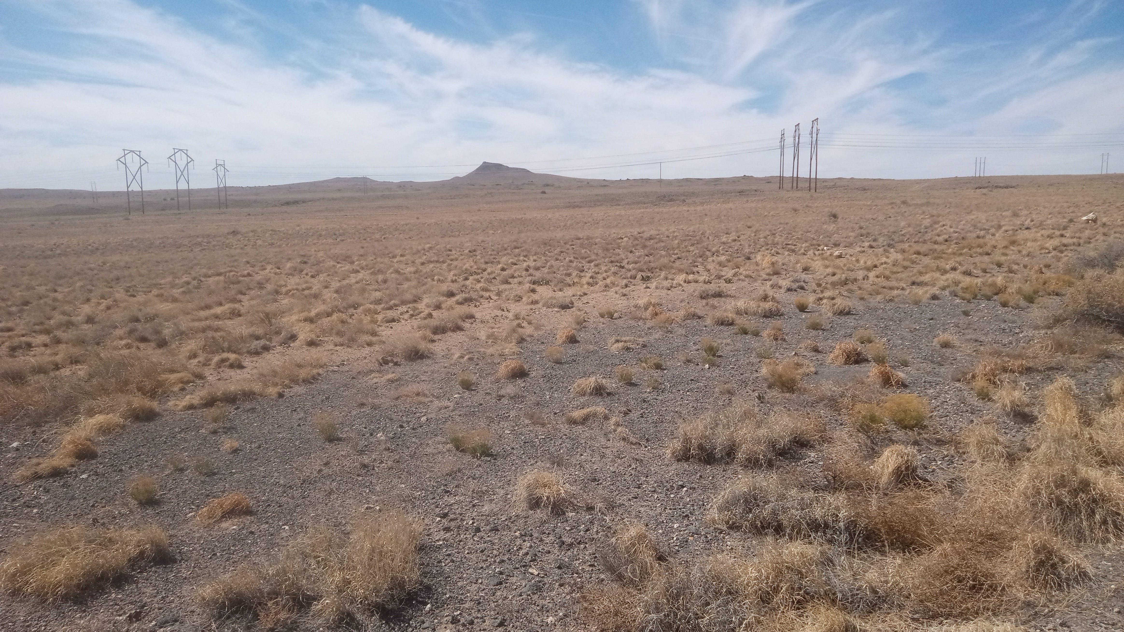
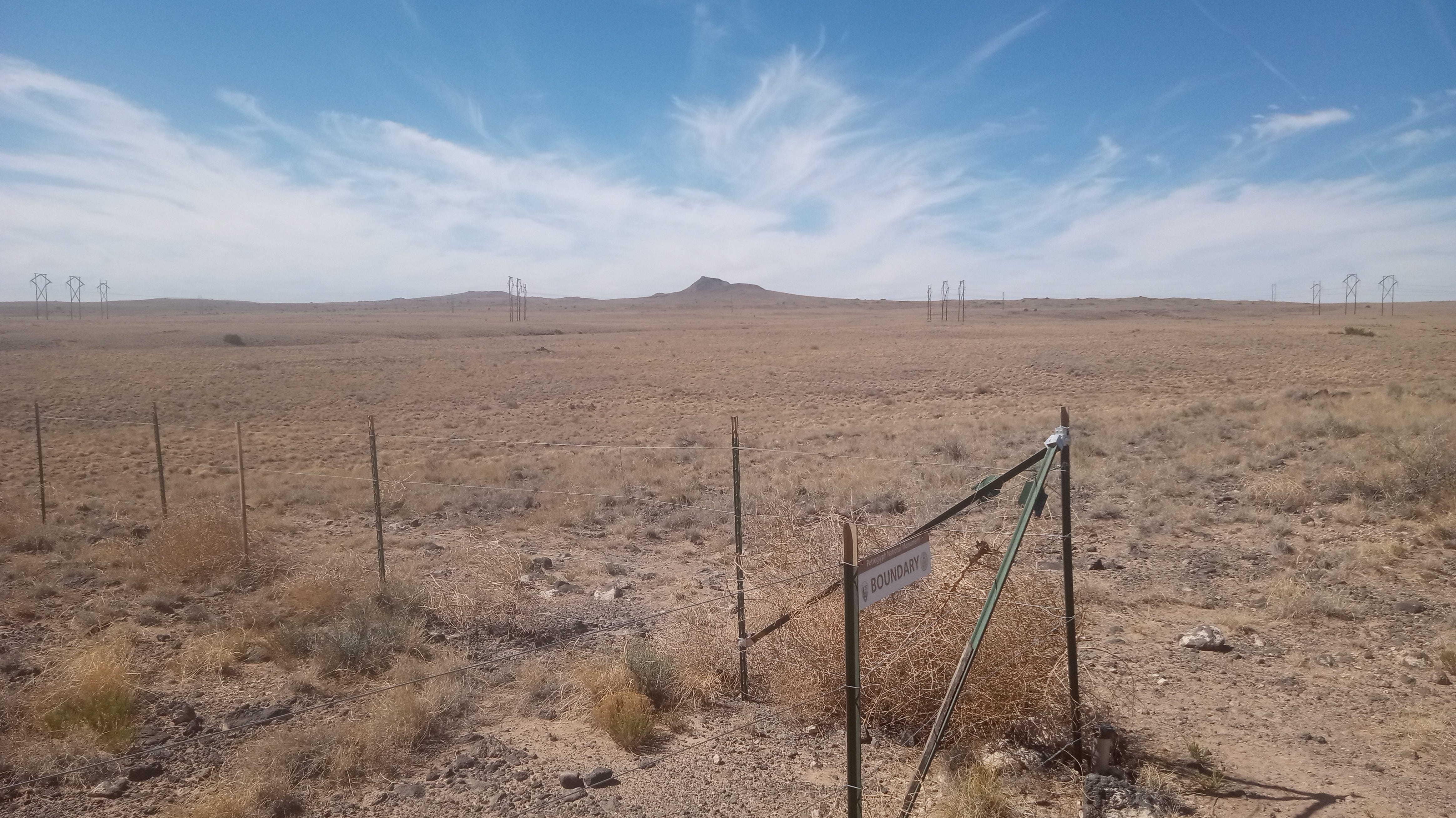
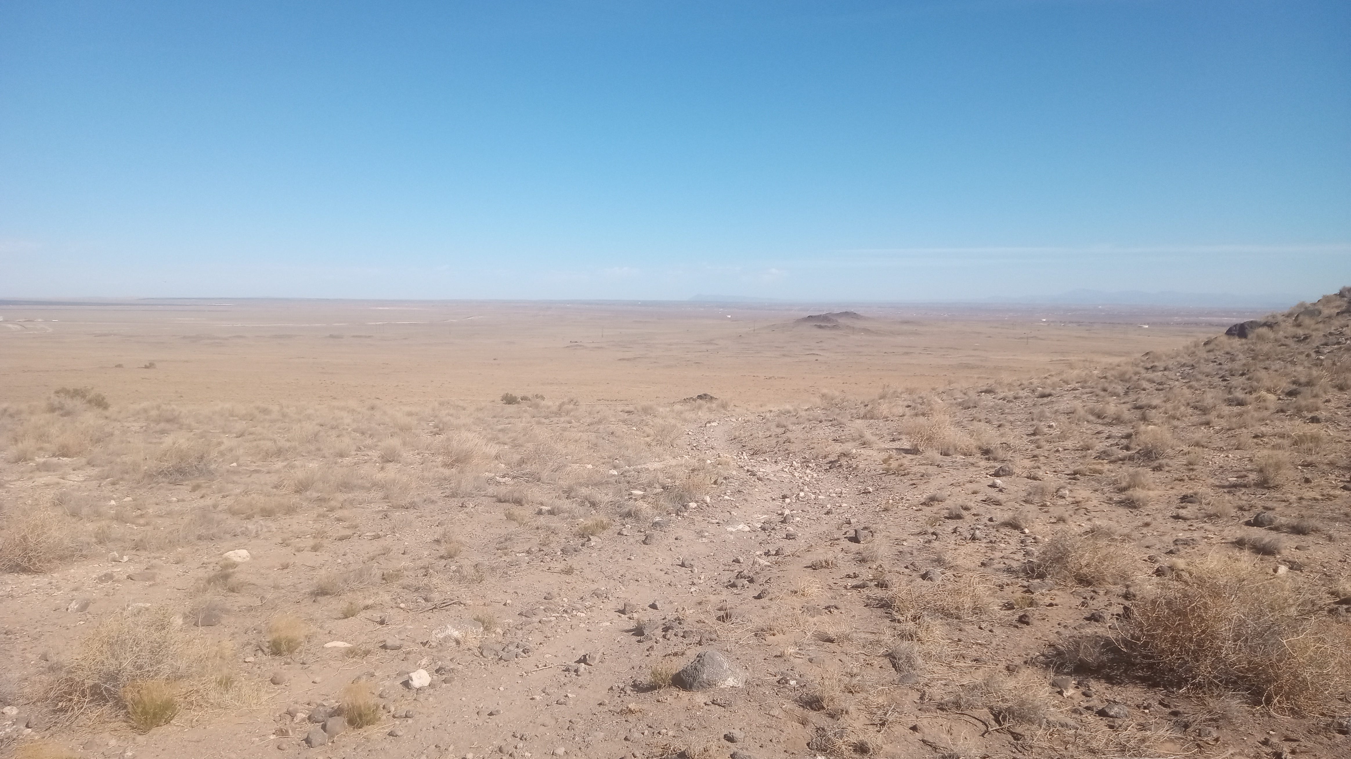
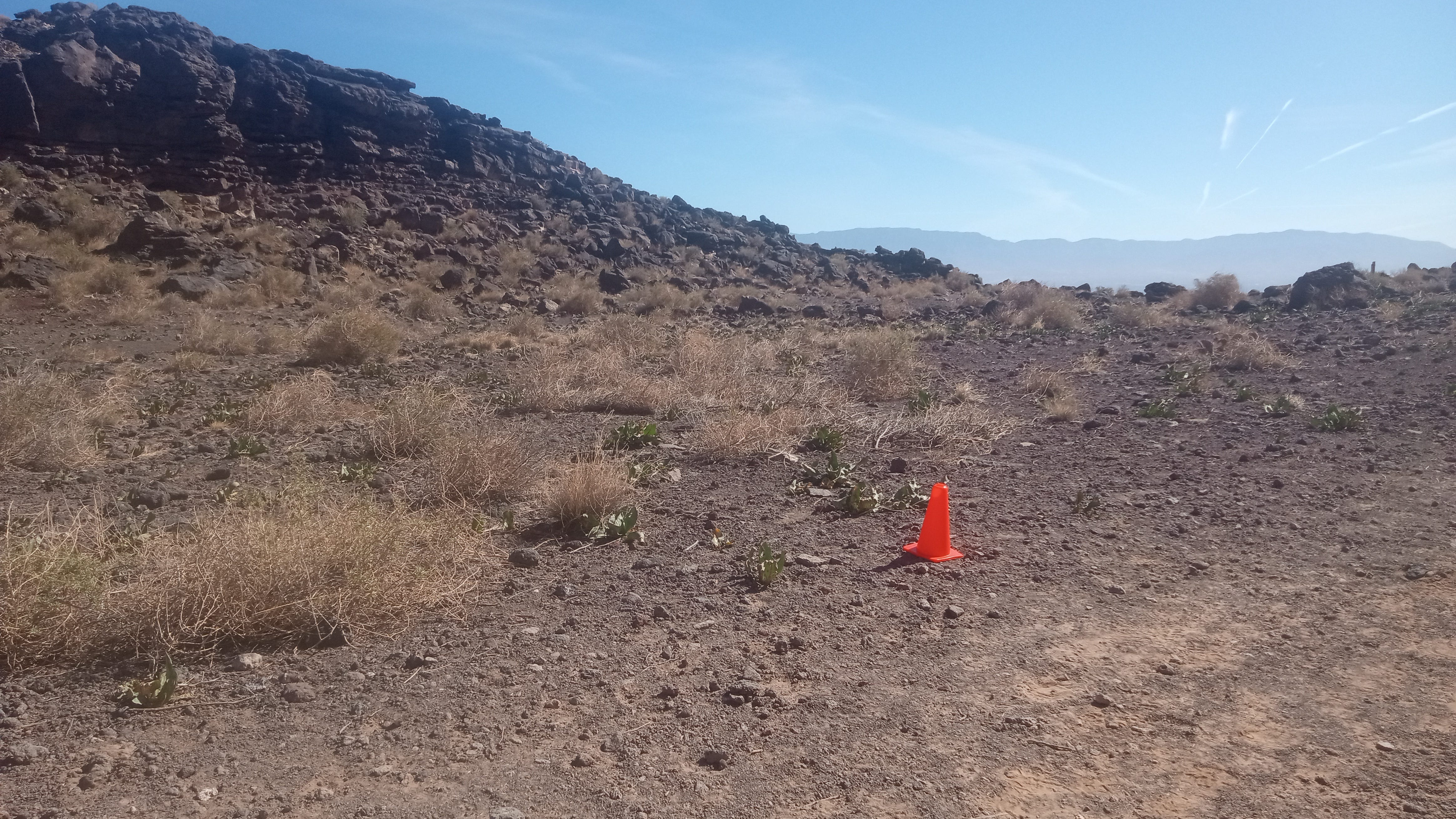
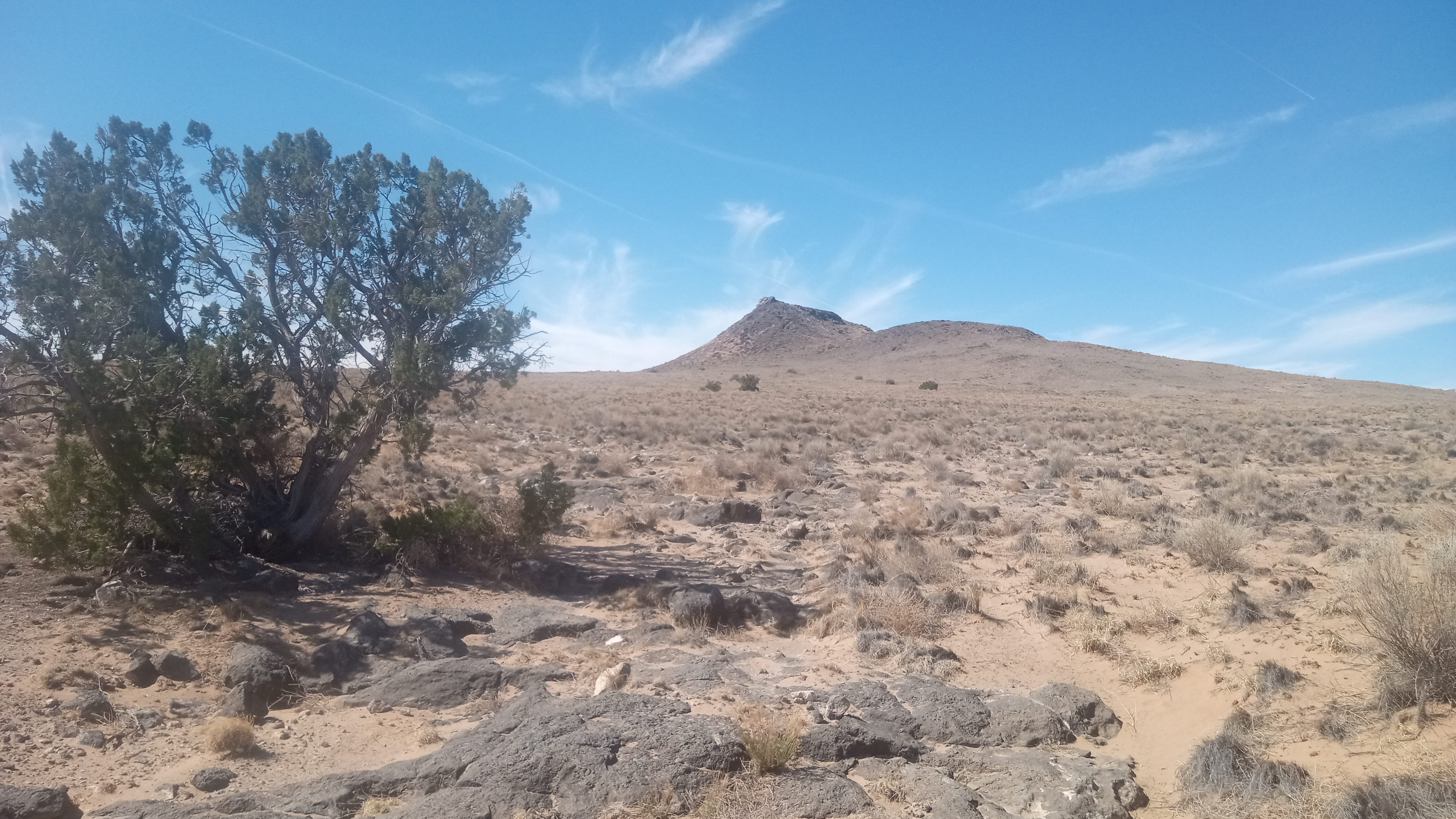
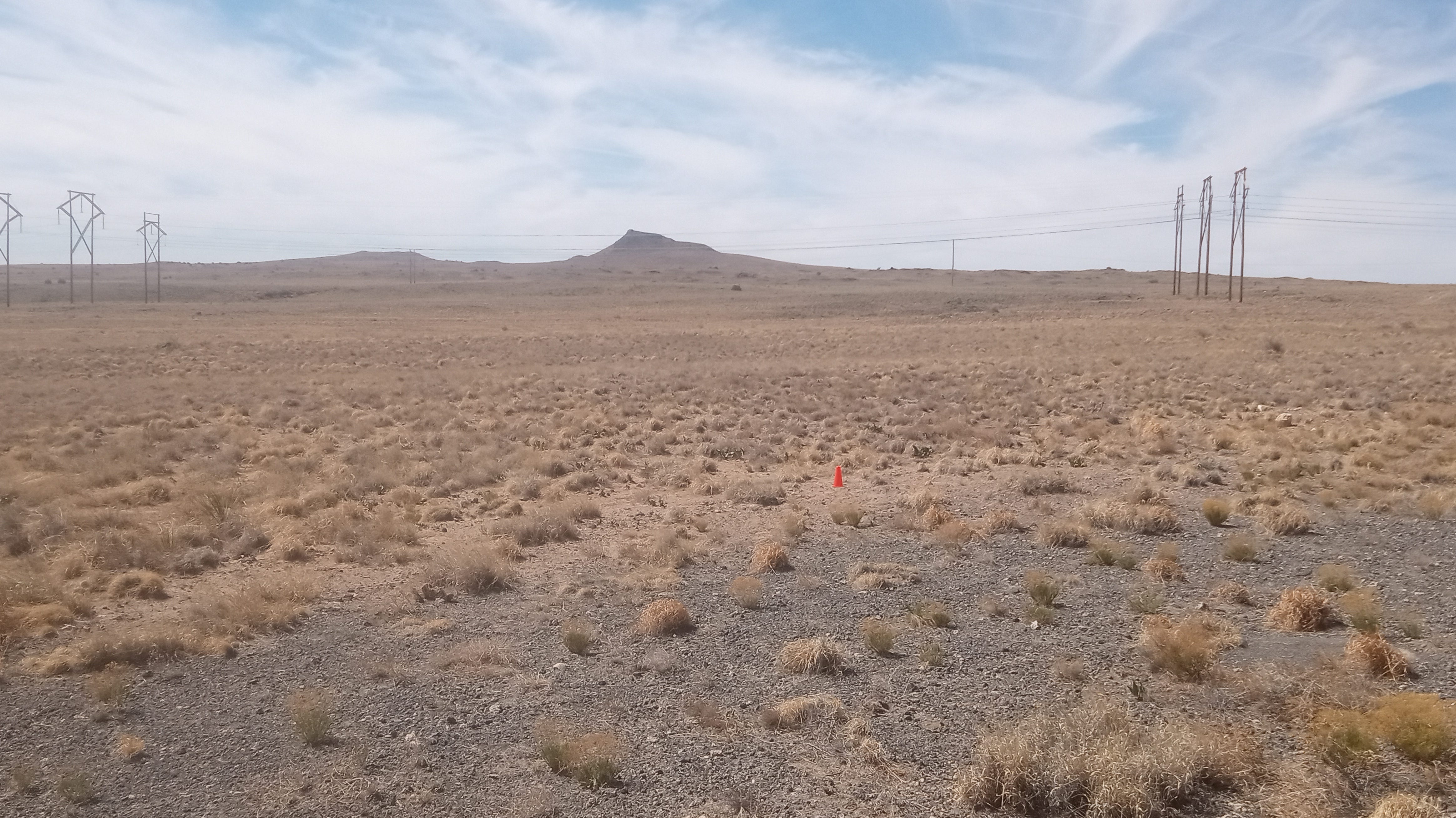
I took these photos after arriving at a trailhead starting app. 1-2 miles to the east. As I investigated the landscape, I considered various factors. There were the powerlines apparently evident from the Prima guide photo. Onsite, these took the form of a set of three large H-frame structure transmission lines, a single line of H-frame structures, and the small, wooden pole distribution line running nearest.
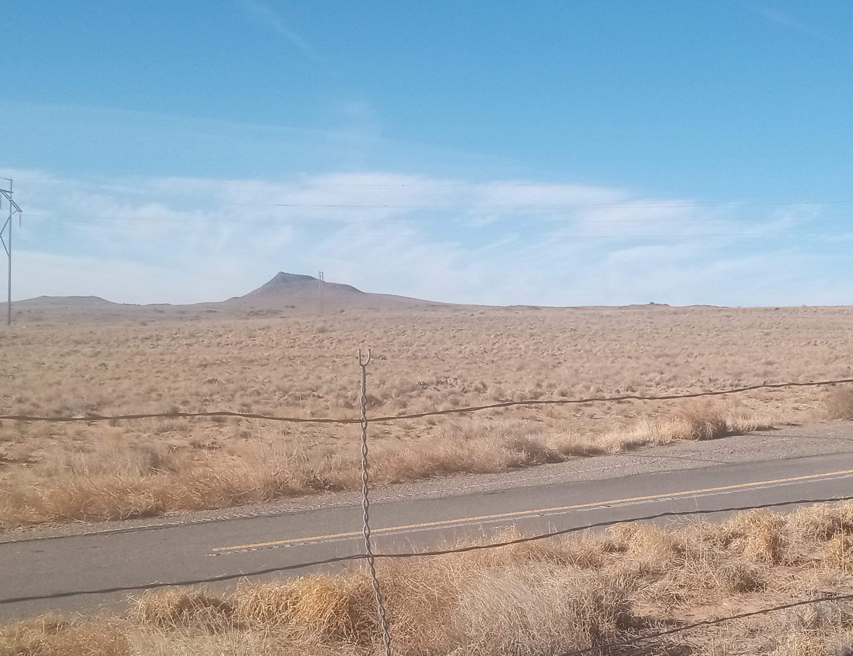
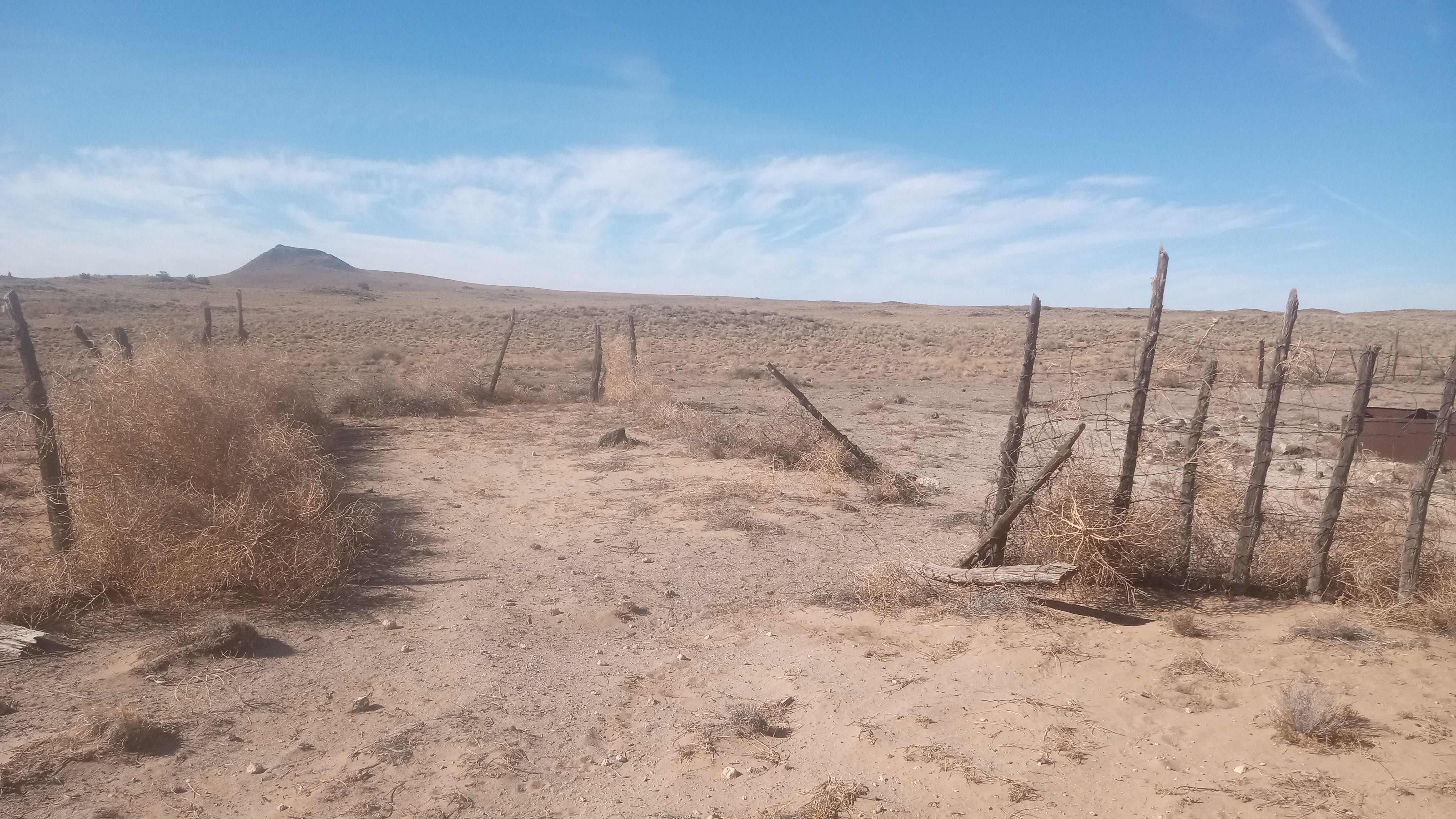
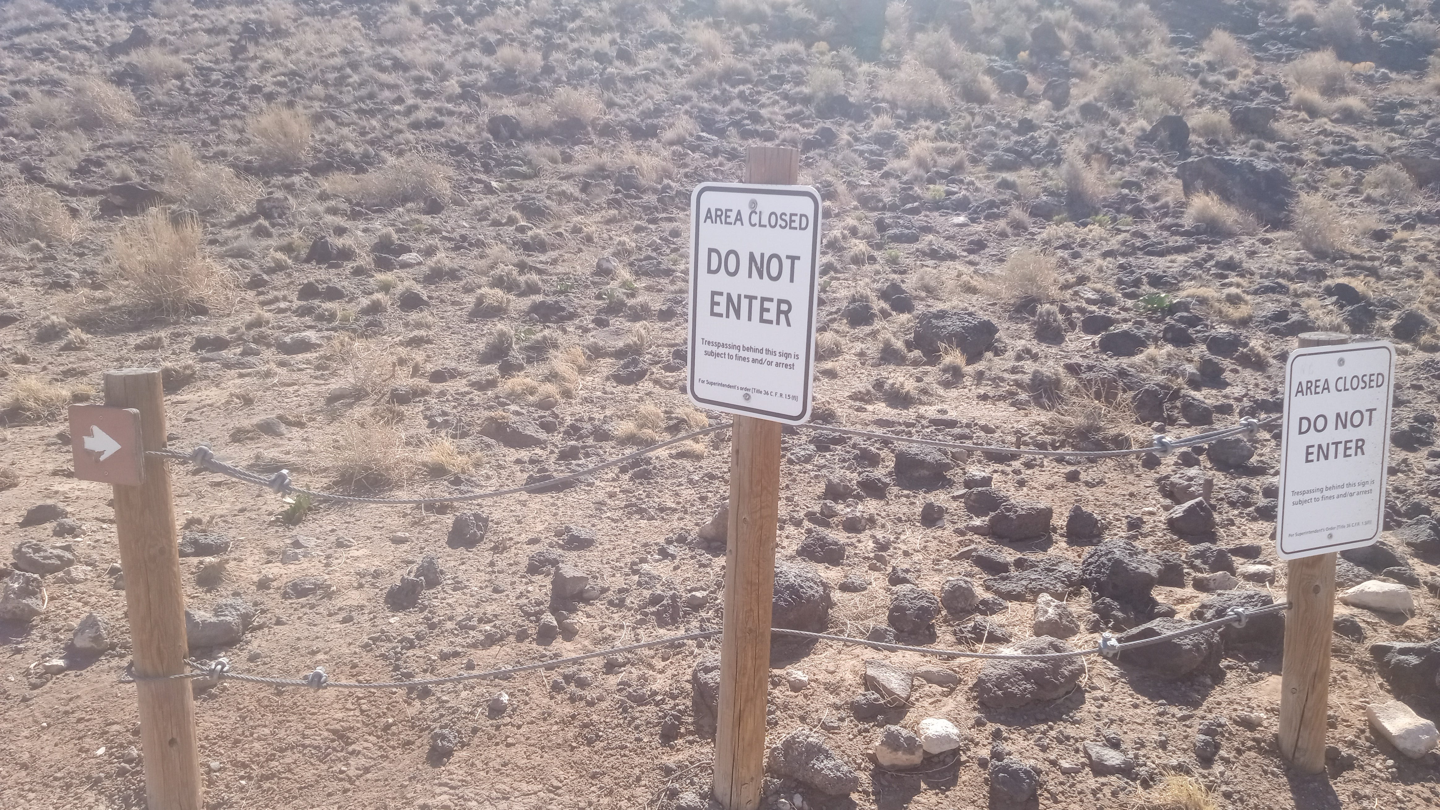
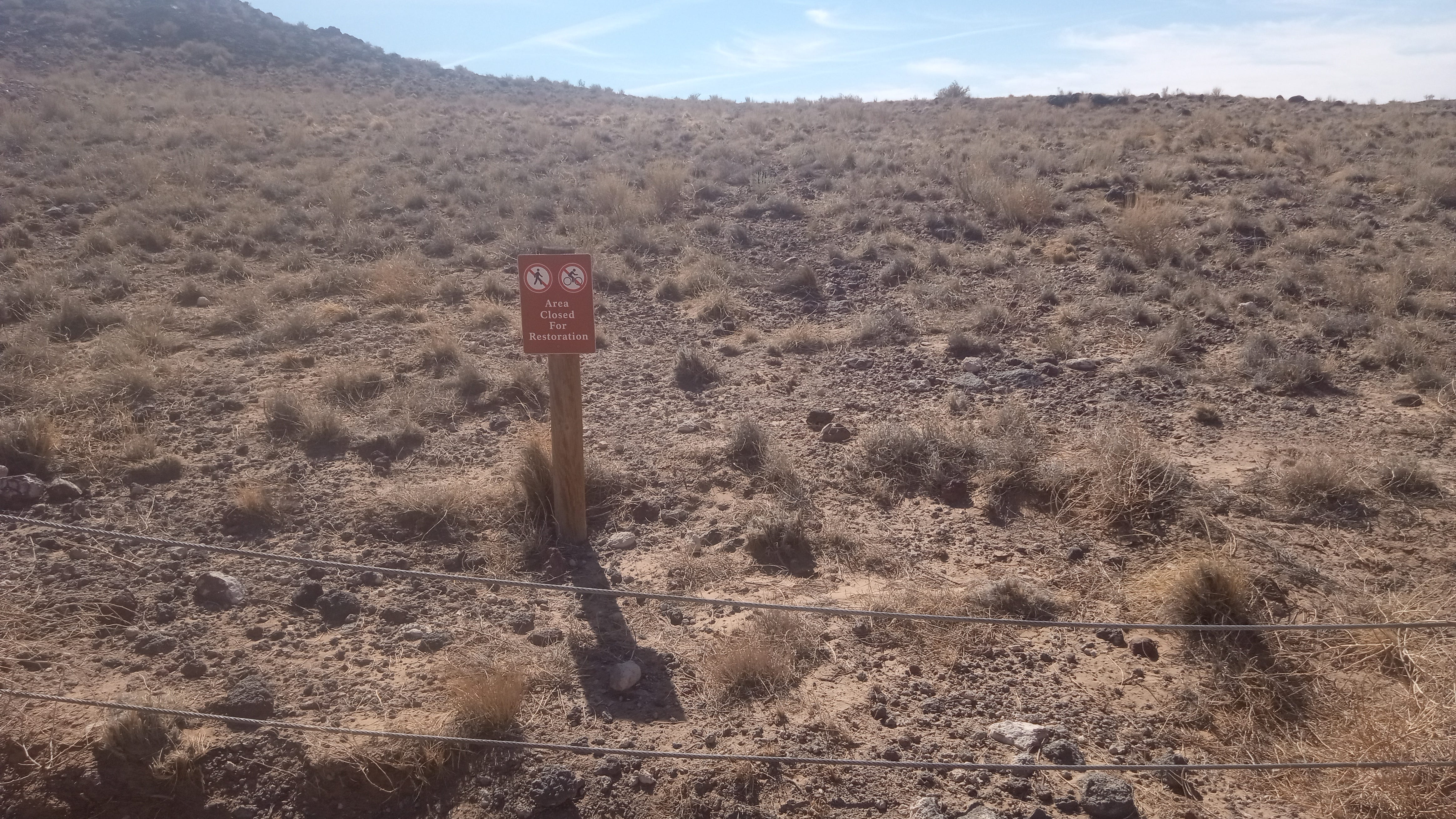
Additionally, there were two barbed wire fences, both in serious disrepair by 2025, running perpendicular (north-south) to the trailhead, as well as one in good maintenance running between the trailhead and the residential road on its north side. Further, there are the Petroglyph National Monument boundary fences which feature a different style and generally run roughly parallel to the powerlines.
These lines and fences intersect each other in many ways over the ~1 sq. mi. area of interest, seemingly providing different opportunities for a match, made more difficult by the indistinct look of Vulcan’s geologic shape in the Cyan photos.
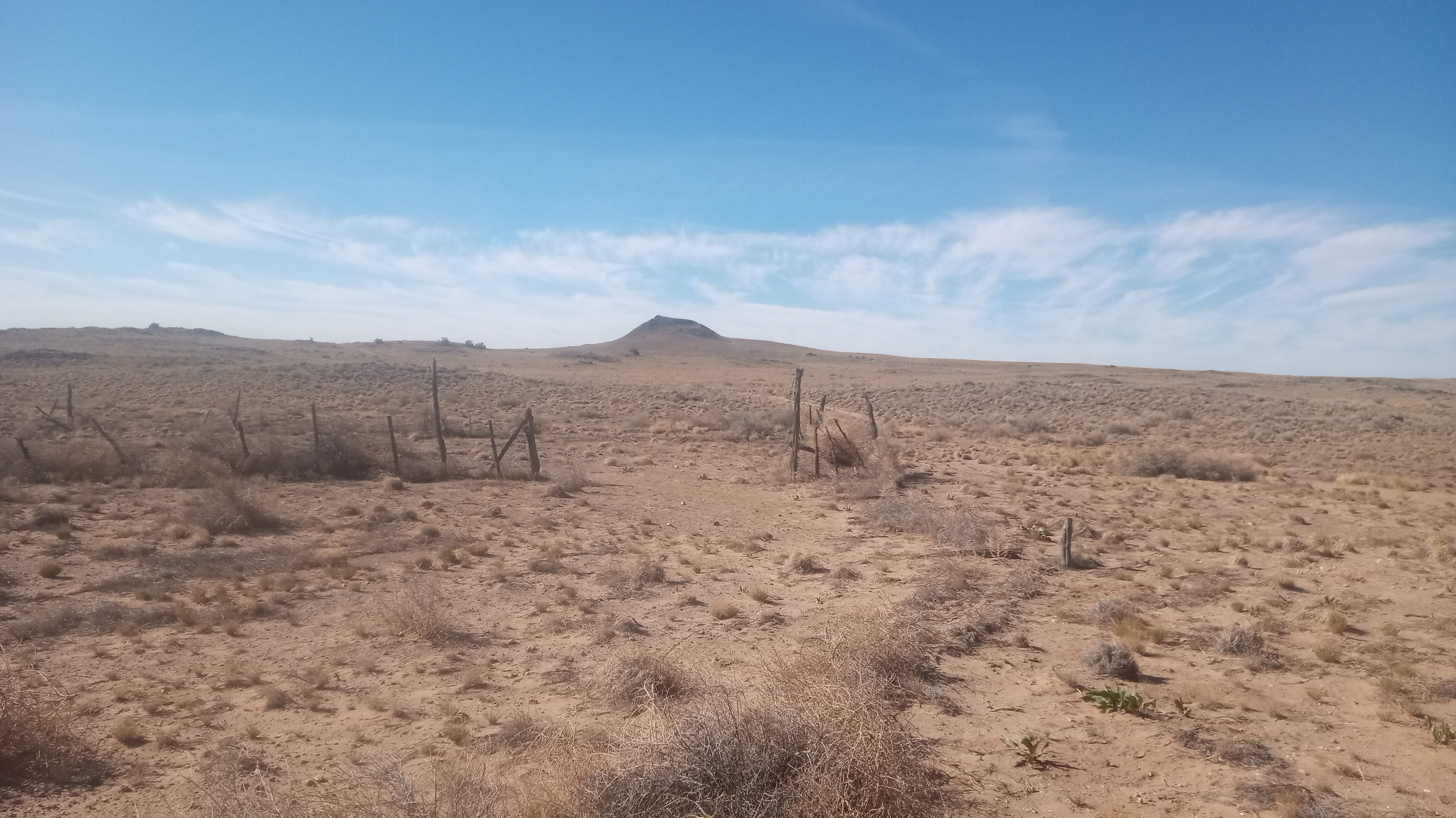
I was expecting to have to travel approximately one mile before the angles of Black Volcano, Vulcan’s main cone, its two parasitic cones, and its northern mound all aligned to the first Cyan photo. Another aspect was the elevation of terrain to the Sisters’ north and east. Various ridges often obstructed my view of some element needed when some seemed to be coming into alignment. And of course, camera distance mattered.
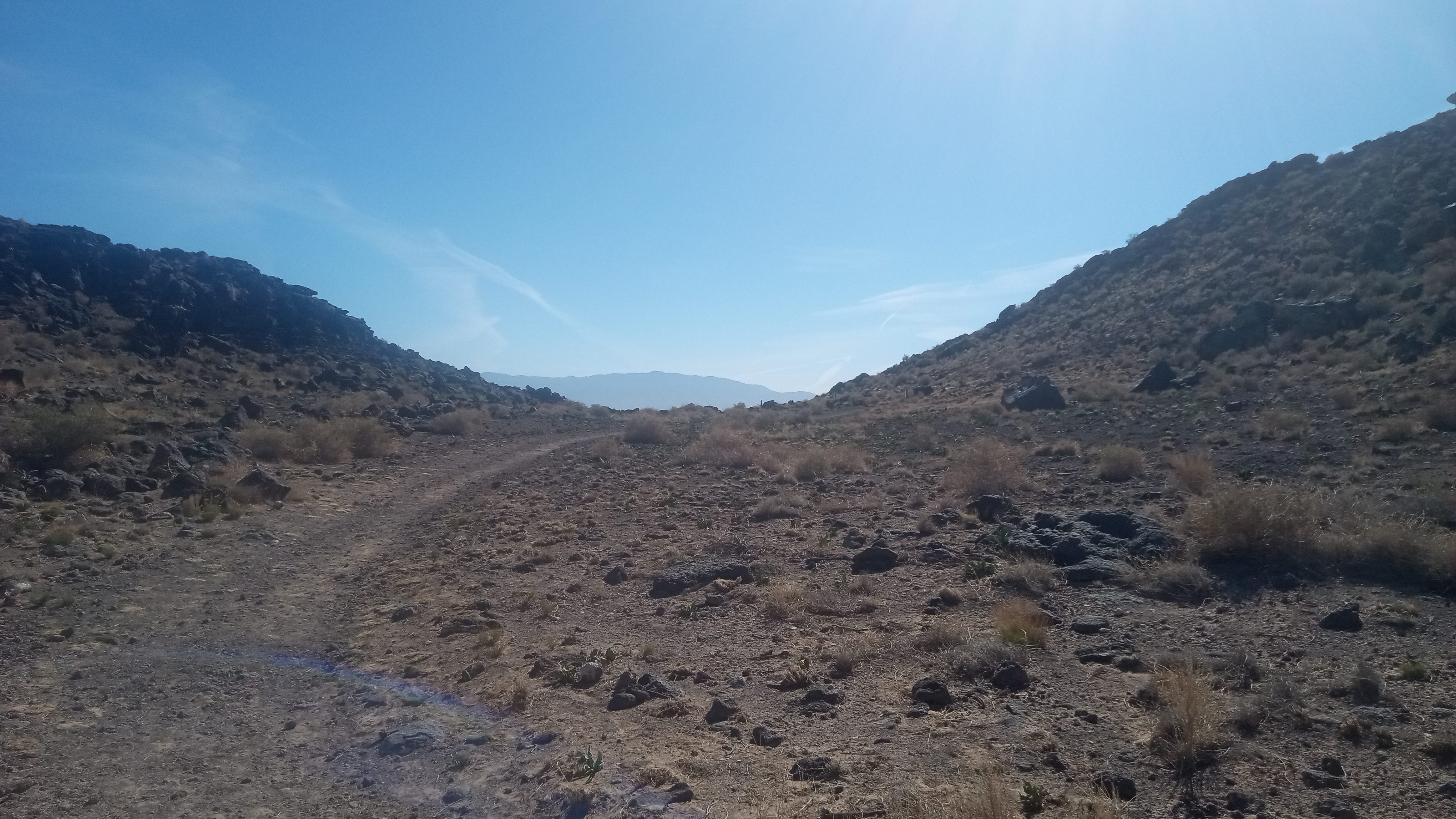
As it fell out, there was a clear moment when all these threads came together.
First, both sets of transmission towers were finally coming to a place where they exited my view towards Vulcan. Then, the elevation I was walking on rose, Vulcan came into harmony with itself and its sister, and the “black mark” of the DRC photo in front of Black Volcano came into sight.
As such, I knew as I walked the last hundred or so steps that I had the exact place. Once I ceased walking under the hot March sun, it was dead silent.
“There is a place.” It is real, and I am here.
A 20+ year mystery was settled. 200 meters down the path, I took the photo matching the Prima guide image. This photo was taken where the initial trail ended, the same place it has since at least the 1990s per historical imagery.
I had the Caldera, and now I continued onto it.
A few scattered notes about the location are worth making.
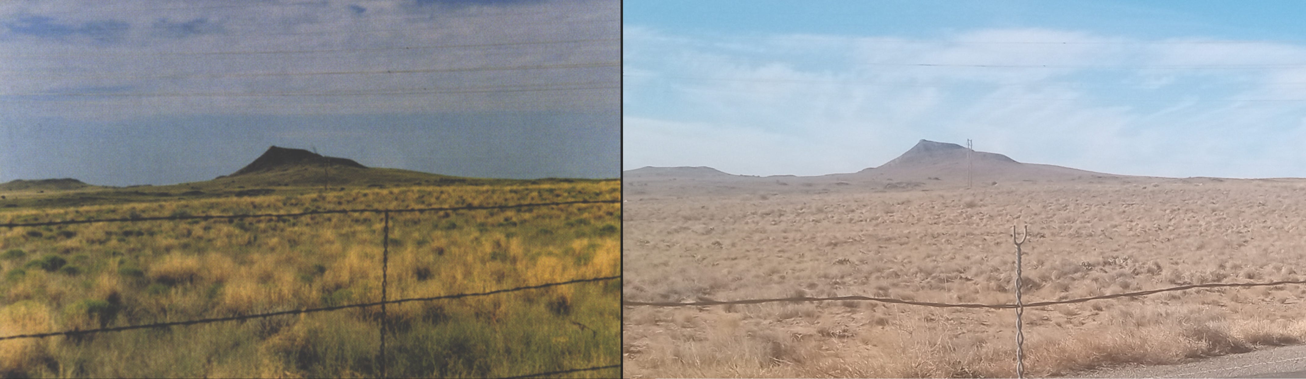
Earlier detours for the Prima guide photo’s location had concerned me that development might have rendered replication impossible. The area was substantially less developed 20 years ago:
This worry proved baseless. The biggest change is that the trail running west became paved rather than dirt.
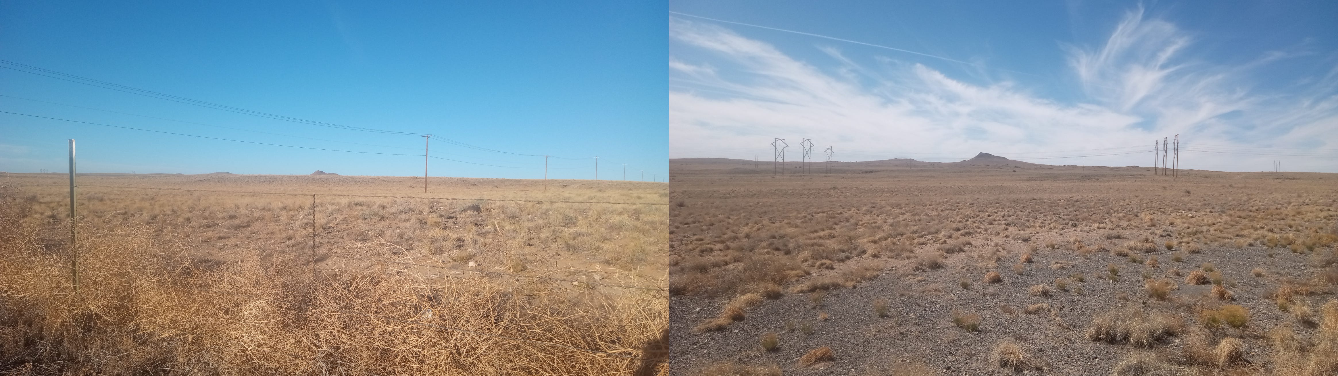
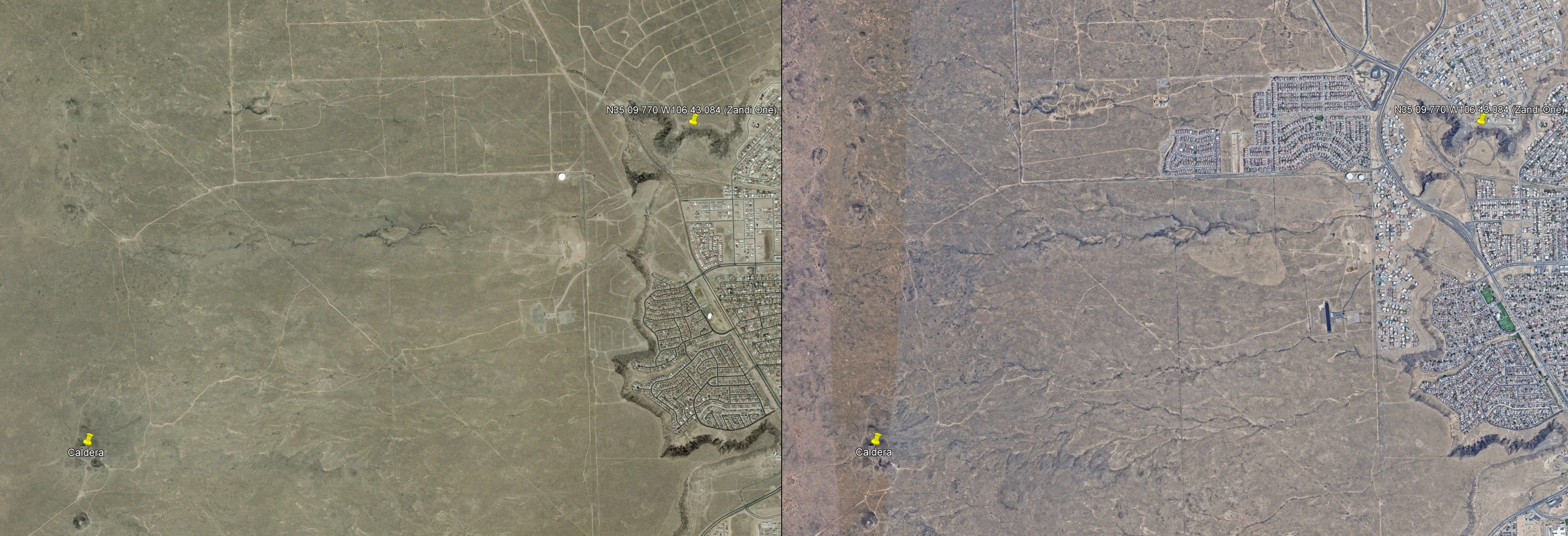
Meanwhile, Zandi One is only ~3 miles away.
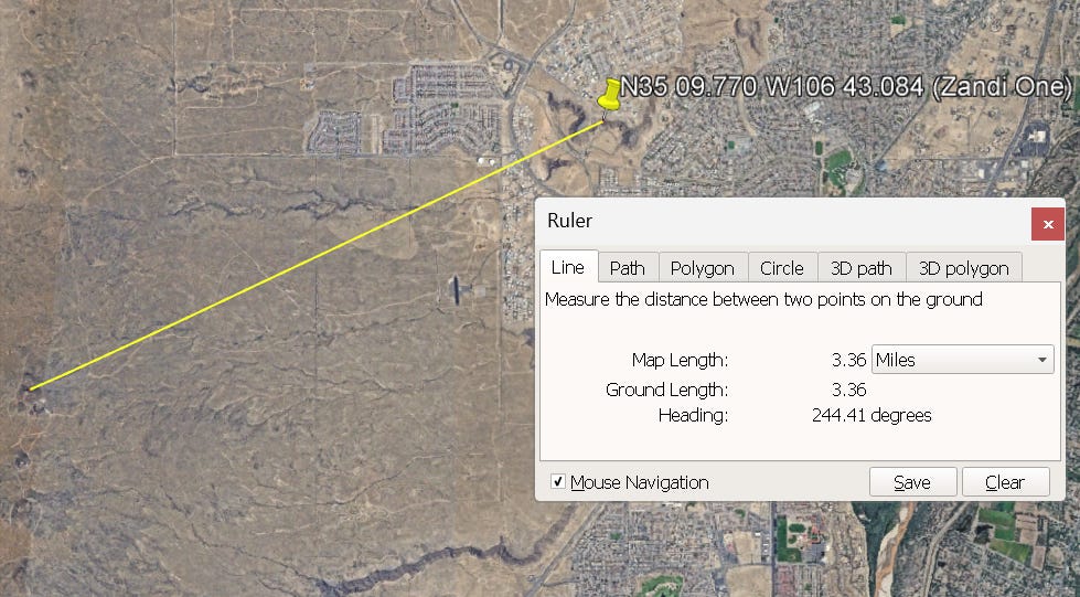
Vulcan would be nearly visible from Z1 exactly, but is likely obscured if you stood at the exact coordinates, due to the cliff to the southwest.
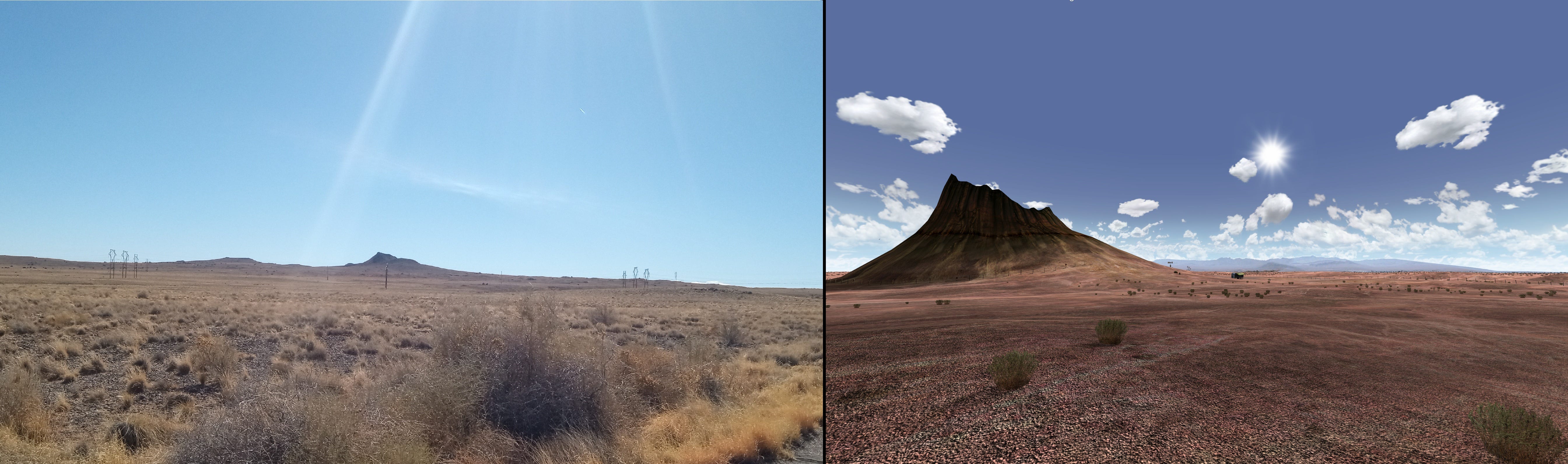
The angle of sunlight also conforms between the in-game caldera and Vulcan:
After confirming Vulcan, I went back to look at Ainia’s work. Not only did she visit the Three Sisters essentially first, but she went back after the first trip, after explicitly ruling them out as candidates, because something about Vulcan especially struck her. I, of course, stood on the shoulders of giants.
Since this volcano is in Bernalillo County, it is worth delineating exactly how and when Cyan established the Caldera in Eddy County, NM.
The canon status of Eddy County is foremost made with the sign in the Cleft that since 2007 has read “Eddy County.” Previously, such as in ABM and CC, the county was illegible, buried in the sand, and it was “New Mexico” that could be read instead.
Update: As far as Alahmnat knows, the reason for this was that a “no trespassing” sign should be facing outward, not inward.
The caldera’s canon status is secondarily provided by the DRC’s defunct website. The DRC listed a Carlsbad address as their HQ: “14617 Old Caverns Hwy, Carlsbad, New Mexico 88220.” As far as I can tell, this was first done in 2007 with the launch of the new website. This address is composed of a major road in Carlsbad, combined with the digits of Cyan’s HQ in Mead, WA. This was not a unique decision either, as this news article from Jan 25, 2007 lists “Carlsbad Cavern, NM” as a reporting location.
Since the earliest 2000-02 rumors circulating about Carlsbad Caverns and Lechuguilla, Eddy County was naturally understood as a location of the game. It was not introduced into the imagination in 2007 by any means, but may have been formally canonized then.
There was once a Bernalillo county license plate in the Cleft. During ABM, Zandi’s airstream originally had a license plate from that county. This was removed when it was noticed that it corresponded to a real-world owner. The new county name became “Zandillo.”
Update: Per Alahmnat, the reason behind the Bernalillo plate was that a Cyan artist just googled “New Mexico license plate” and simply used a result at random.